A deep sandy trail took us from the parking lot to Horseshoe Bend. It was flat until half way. The rest of the distance was a little uphill. But not that hard. We walked looking at the valleys here and there in the distance. All that is seen in the left, right, front and back are only red rocks.
At the end of the path some of the visitors were standing on top of red rocks and looking down at something. Some seemed to be queuing up from the cliffs waiting for them to come down. As we neared them, we realized that we had reached Horseshoe Bend Overlook. I looked at my watch to see how far we had walked. It showed 0.7-mile distance. The biggest red rock is 4,200 feet above sea level. 1000 feet from its summit is a river stream that pierces it. The stream curved itself and presented us with a horseshoe shape. The river stream is a part of Colorado River.
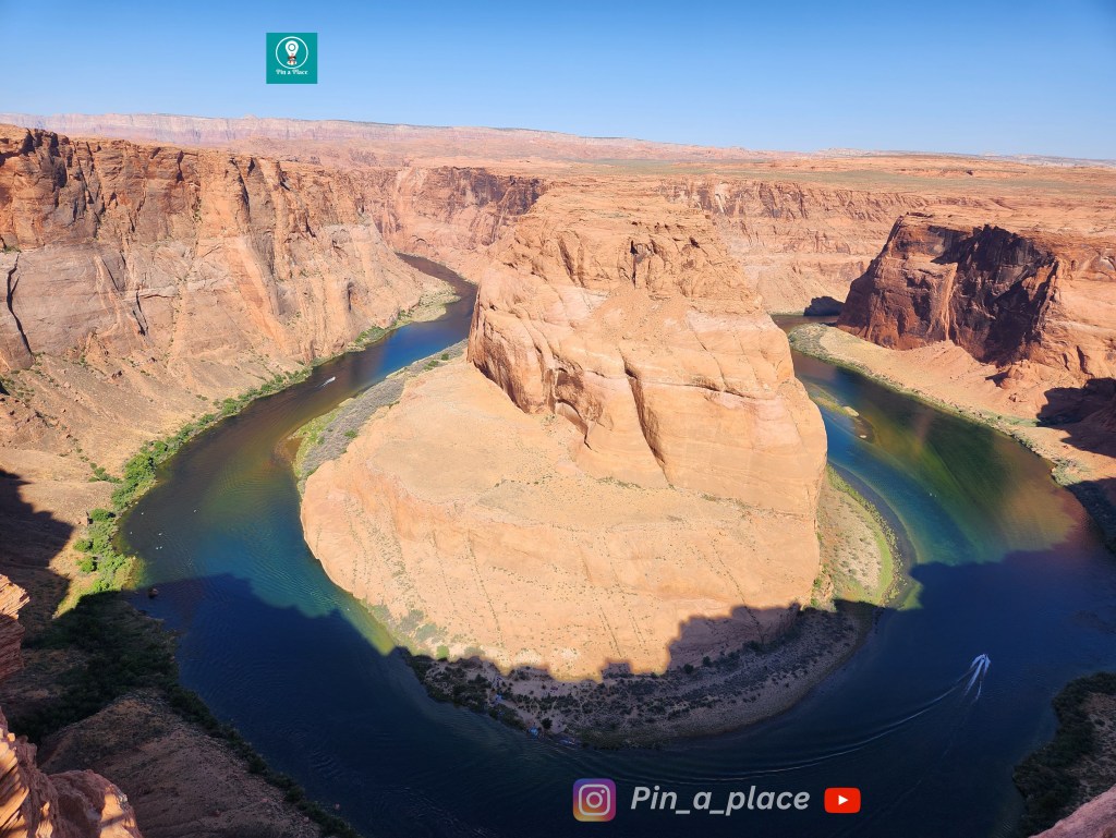
Standing on the edge of red rock, we could see the river flowing 1000 feet below. Some rafts were moving slowly in the river stream. The speedboats overtook them, tearing up some water and throwing up foam. All these views resemble an aerial view of a lake to us from the overlook.
More useful information
Do you need a reservation to see Horseshoe Bend?
Can I go to Horseshoe Bend without a tour?
How far apart are Antelope Canyon and Horseshoe Bend?
How far is Page from Horseshoe Bend?
Is there an entrance fee for Horseshoe Bend?

Leave a comment